NEW YORK, NEW YORK
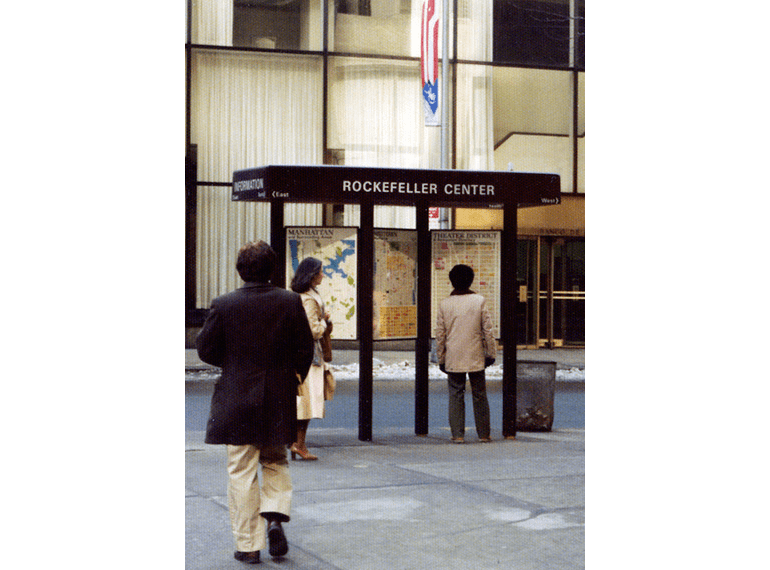
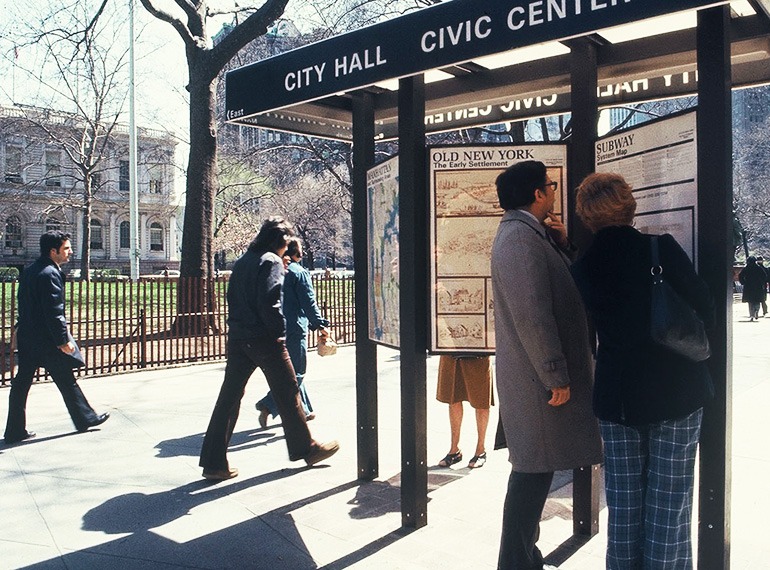
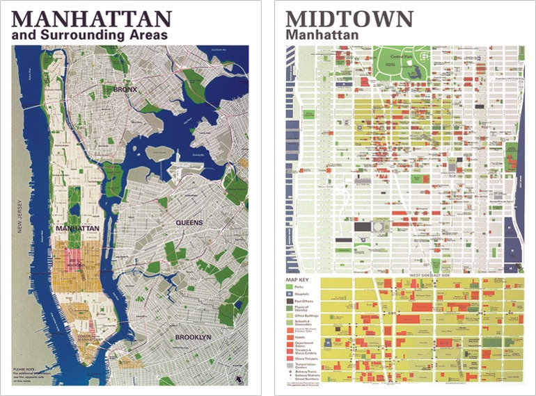
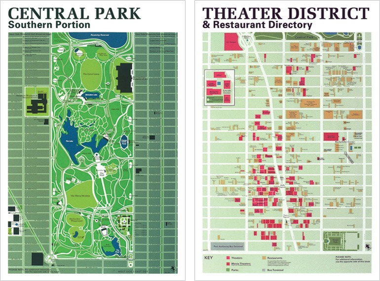
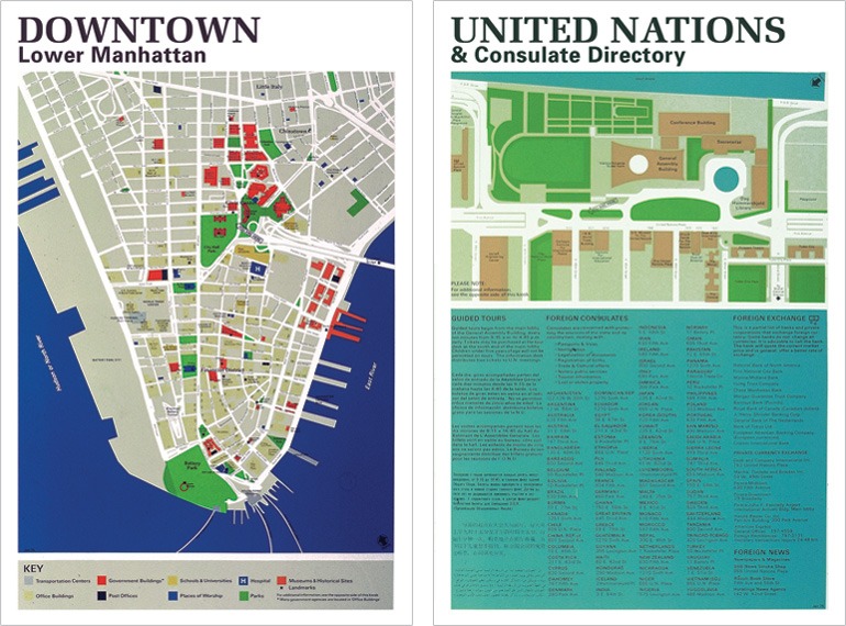
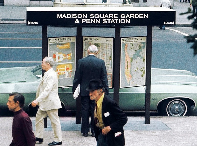
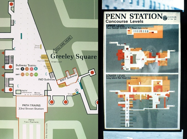
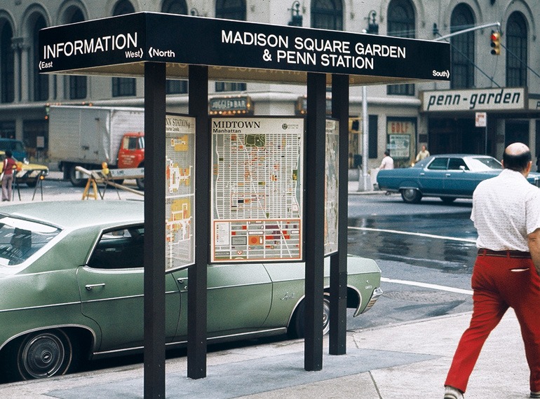
Working within the Transportation Administration for the City of New York, a pioneering project to provide transportation and directional information about general and neighborhood areas at the street level was developed for the City of New York, the first of its kind. Installed at 14 different locations at key locations throughout the City a series of 3, double sided panels with a roof that provided some weather protection and basic orientation and location, created six opportunities for display: bus map, subway map, a City-wide borough map of Manhattan and environs, a map of Midtown and with a detail map and two additional maps with relevant local information that included: a theatre district map, Central Park map, United Nations information, Penn Station map, etc. This project was carried out completely by the construction personnel within the Department of Highways and the design team of the Urban Design Section within the Transportation Administration. Installed in 1976, the kiosks remained in place their various locations until about 2003 and represented the first real attempt by the City to provide an information system to the people of New York City.
Pedestrian Information Kiosk Team:
New York City Transportation Administration:
Manual Carbarllo, First Deputy Administrator of Transportation
and Commissioner of Highways
Daniel S. Garvey, Deputy Commissioner of Highways
Urban Design Section
Frank A. Rogers, Director
Alan J. Lindenfeld, Assistant Urban Designer
Tracy Turner, Principal Illustrator
Herbert Hong, Senior Illustrator
Kathleen Schenck, Senior Illustrator
JoEllen Smith, Senior Illustrator
Rise Goldstein, Illustrator
David Trachtenberg, Illustrator
More Projects
Client: Jane Doe - Envato CEO
Fantastic product, my sites all run super fast and the support is excellent! Great to work with, good communications skills.
Client: Jane McDoe - SEO Expert
Very pleased with Workspace. Hope to have continuing business with them again.
Client: Jane Doe - Coding Expert
Excellent freelancer. Fast worker and knows what he's doing and his communication is very clear. Product was delivered in great shape.
